

Sailing from the Aegean to Sicily and the South Tyrrhenian
By Dimitris & Aikaterini Liaroutsos
It has been six years since my first sailing exploration trip to Magna Grecia and I thought it was time to publish photos and short stories of this magnificent Greco-Roman archeological sites. This sailing trip ignited our interest in the varied cultures that flourished under the Greeks, then the Lucanians and the Etruscans.
The aim of our trip was to see and feel the importance of this migration, as it greatly influenced the western world. Reading some great historians, we tried to find the origin of the settlements and realised that the “how, why and when” of this great diaspora is still a puzzle. However, it is obvious that Magna Grecia was transformed not only by trade but by the religion, the style and the ideas. The Diaspora Greeks boarded ships to be carried hundreds of miles away because of famine, overpopulation, climate change or war.
We sailed south of Peloponnese just like the Euboians, the Megareans or the Islanders of the Aegean and arrived where they built their settlements between the 8thand 6th centuries B.C. in Sicily and southwestern Italy.
MAP OF MAGNA GRECIA WITH ITINERARY
Although our voyage was done with a modern boat we never stopped talking about the adversities the ancient navigators faced due to the simplicity of their ships. We started our trip from the island of Serifos with a strong northerly wind, force six. We did not stop discussing about the leeway these ancient boats would have due to their displacement, beam and draft.
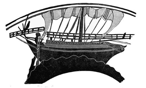
Greek merchant ship. About 500 B.C. 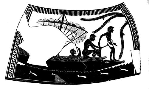
A greek galley without a deck. About 550 B.C.
Also we thought of the difficulties these boats had to point to the wind. Discussed the unknown power of the boats, either in a calm, using oars, or with gale force winds using their square sails. Those navigators must have nursed the art of navigation using only simple geometry, the sun, the stars and the human power. They had developed the art of shipbuilding using pine trees from forests in Euboia, Corinth and Samos and had produced first class warships and smaller vessels for commercial use.
These ships had a single mast with a very large yard carrying a square sail. We are not sure whether they had shrouds as on today’s boats, but Homer mentions that the masts of early Greek vessels were stayed fore and aft. Unfortunately, most of our knowledge comes from the designs on Greek vases found that usually show war ships and scarcely commercial vessels. We know that oars were very important and some of the big vessels had one or two decks.

Greek unireme. About 500 B.C. (copy of a greek vase) 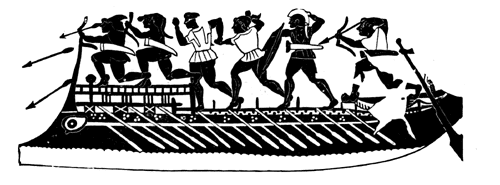
Greek galley with deck. 600 B.C. (Etruscan)
We never stopped discussing the unique position for colonisation of the Corcyrians (from Corfu) and the Corinthians. They took advantage not only of the nearby forests but also of their position, giving them access to the Ionian islands. They proceeded further west losing sight of land to Italy and further to Marseilles or even passing the Pillars of Hercules.
Armenistis sailed on a reach with the wind from the North from Methoni to Syracuse exactly 311 nautical miles and a true course of 274 degrees. Moderate waves were making the trip very comfortable and the wind kept the summer temperature very pleasant. Our night watches planned in advance, with three adults and two youngsters gave us the comfort three-hour watches (one adult with one child X 2, plus one adult alone).
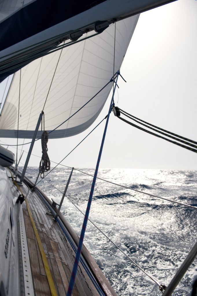
With good wind Armenistis was moving fast 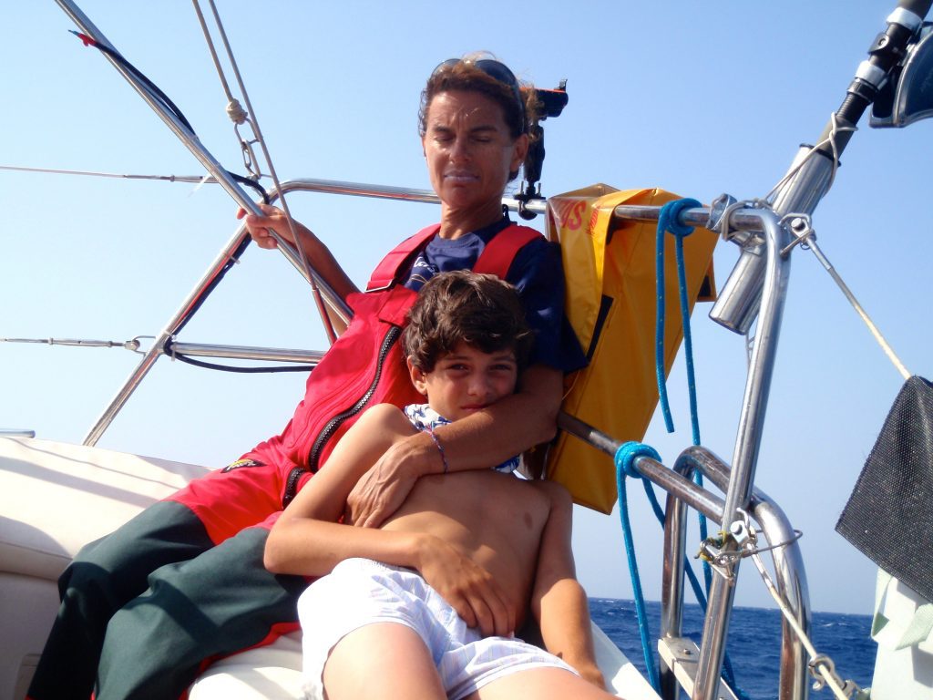
Crew supporting each other while heeling 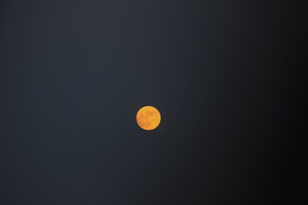
Fool moon Ionian Sea
We reefed with wind of 20 knots in the evening but soon the wind dropped so we went back to full sails. The second day the wind dropped to 10 knots with a slight change indirection and the night turned into 2 to 5 knots when we started the engine. An enjoyable voyage on a beautiful blue Ionian, many whitecaps and the unique sunrises and sunsets … till we arrived in Syracuse early dawn.
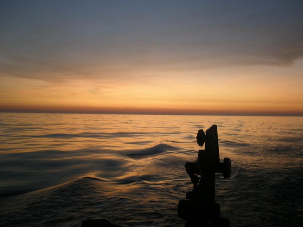
Five miles from Syracuse looking towards the sun rise. 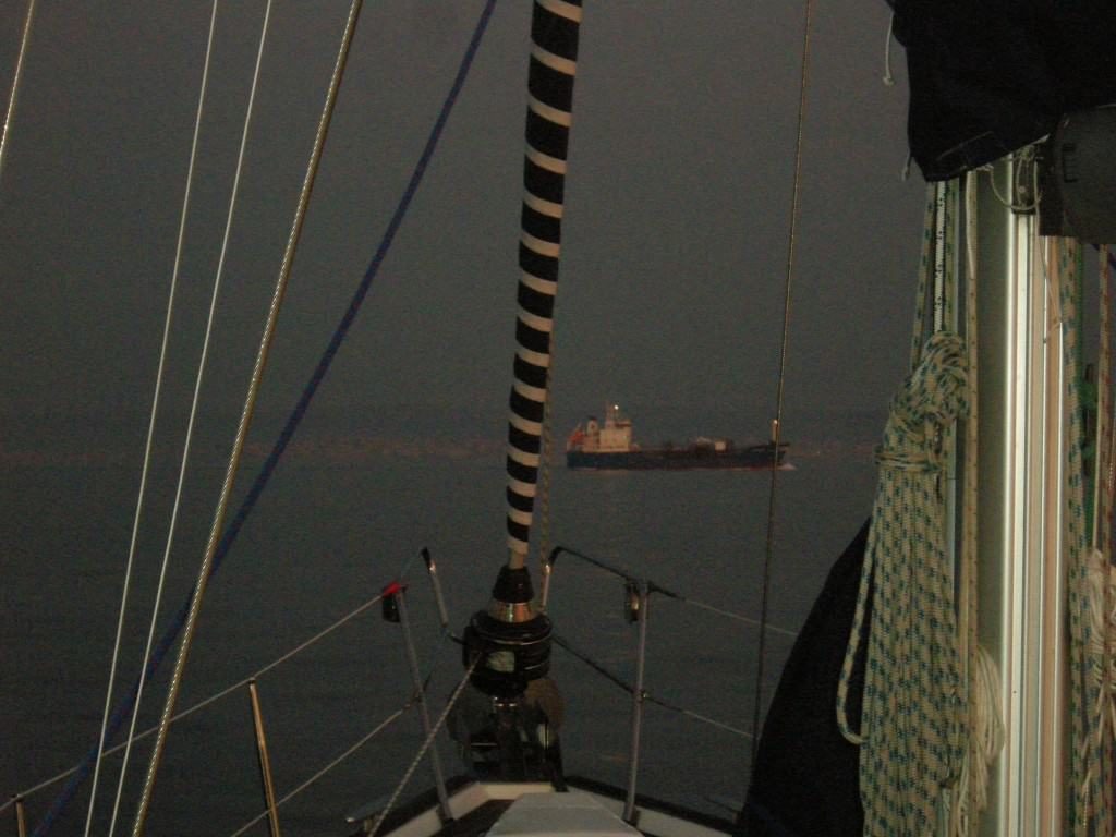
Meeting outside Syracuse with a coastal motor ship.
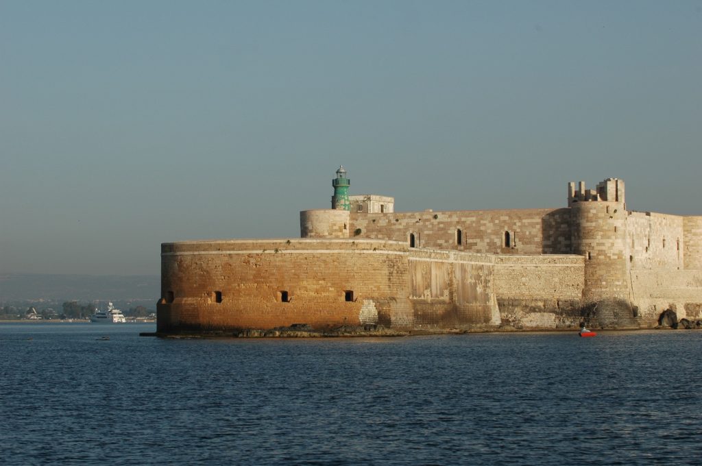
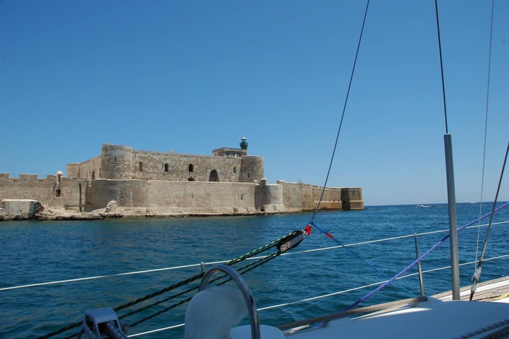
Entering the natural port of Syracuse and leaving Ortygia in our starboard
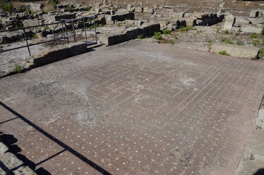
Syracuse was founded in 733 B.C. attributed to a group of Corinthians led by Archytas who together with Myskellos the future founder of Kroton (East heel of Italy) visited Delphi to find out about their voyage. The reply to the oracle’s question by Archytas was “riches” and Myskellos “health”. The earliest settlement was on Ortygia peninsula and still remains the center of the modern city with beautiful buildings. The city has been under the process of recovering since the 1990s.
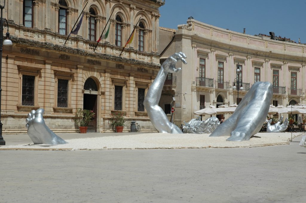
Syracuse Ortygia’s main piazza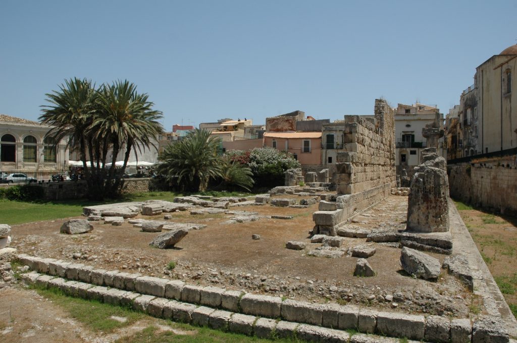
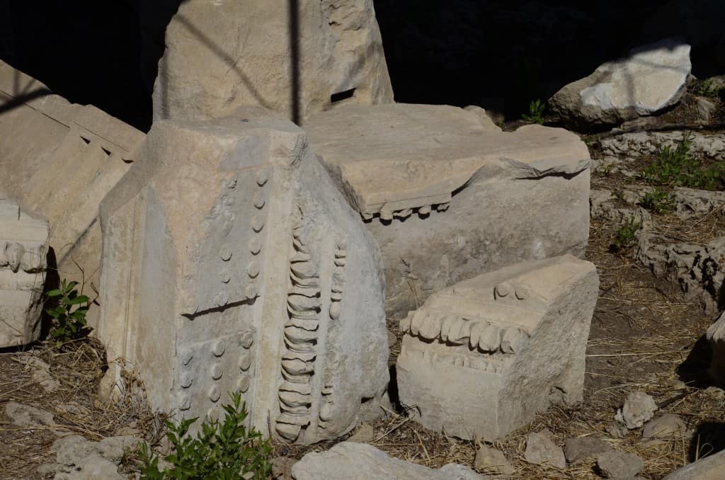
The Temple of Apollo in the city of Syracuse 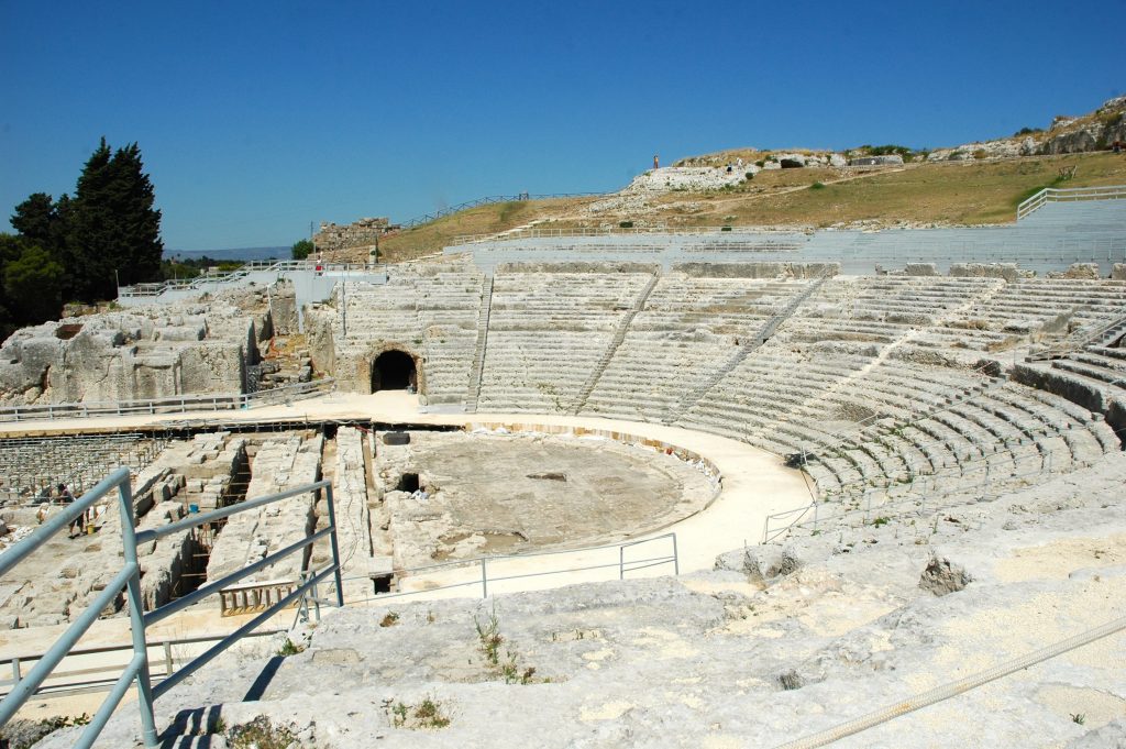
The Ancient Greek Theater of Neapolis in Syracuse, one of the largest in the world, about 150 metres in diameter 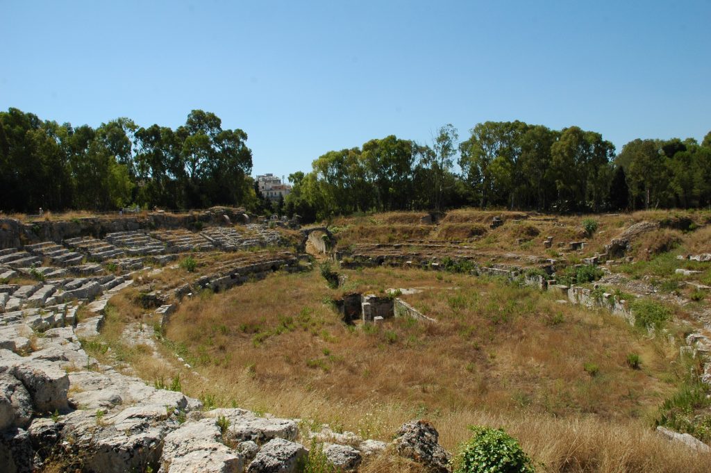
The Roman Amfitheater 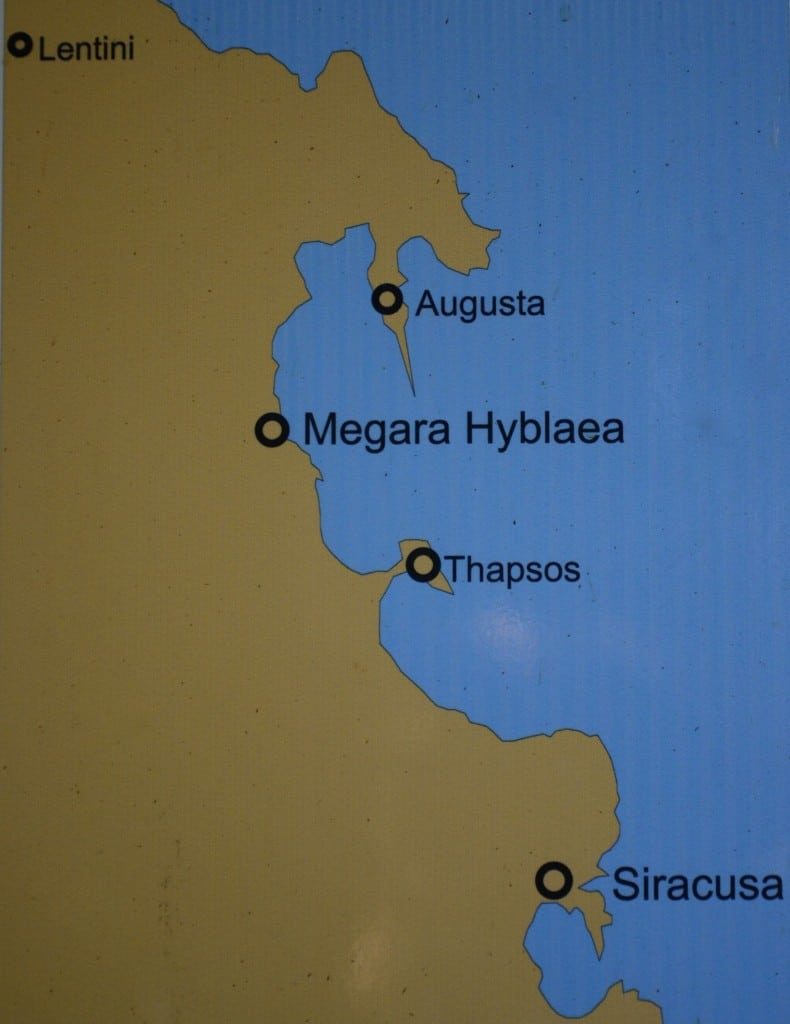
Megara Hyblaea
It was a smart decision my wife and I took to start our search for the ancient city of Megara Hyblaea early in the morning. It took us only forty minutes to find the site, driving in a labyrinth of fields and petroleum refineries. When we arrived we knocked on the door of the guard’s house who was finishing his “colazione”.
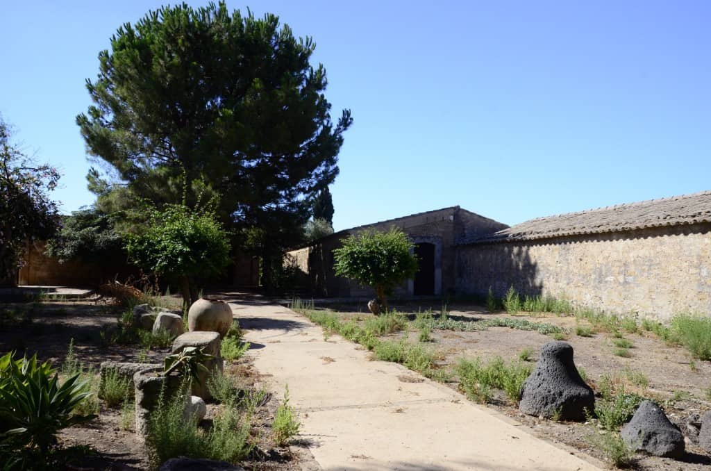
Entrance of the museum 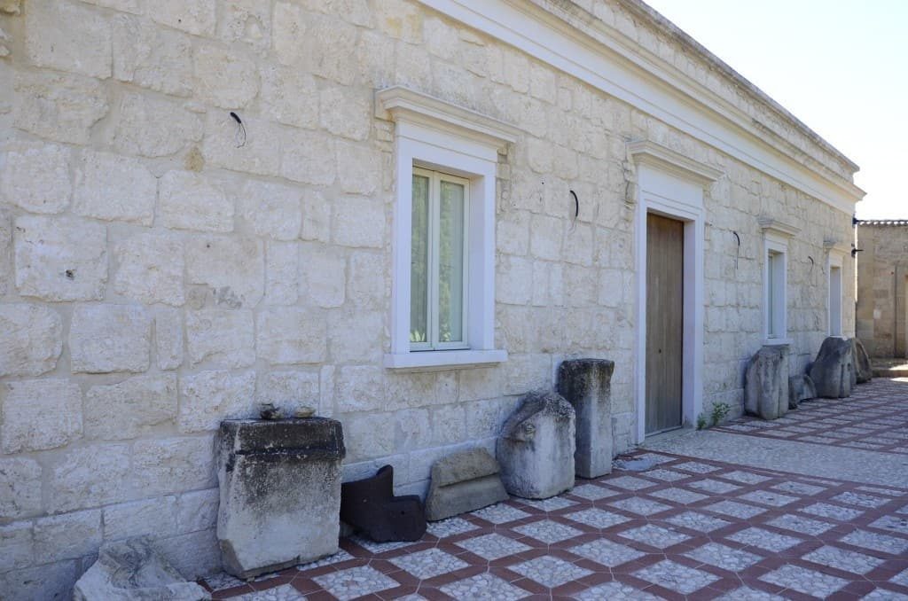
He was surprised to have visitor sat this time of the day. We paid our entrance fee and he walked with us to unlock the padlock of the gate and he returned home.
What a joy, alone surrounded by the ancient ruins of one of the best known Sicilian colonies from an archaeological point of view. It was established by Megarians in the 8th century and destroyed by Gelon the tyrant of Gela in 483 B.C. The city was called Megara Hyblae from Iblon the name of the Sicel king who donated the land on which the city was built. The city was a model of urban settlement in the archaic period with its space well defined.
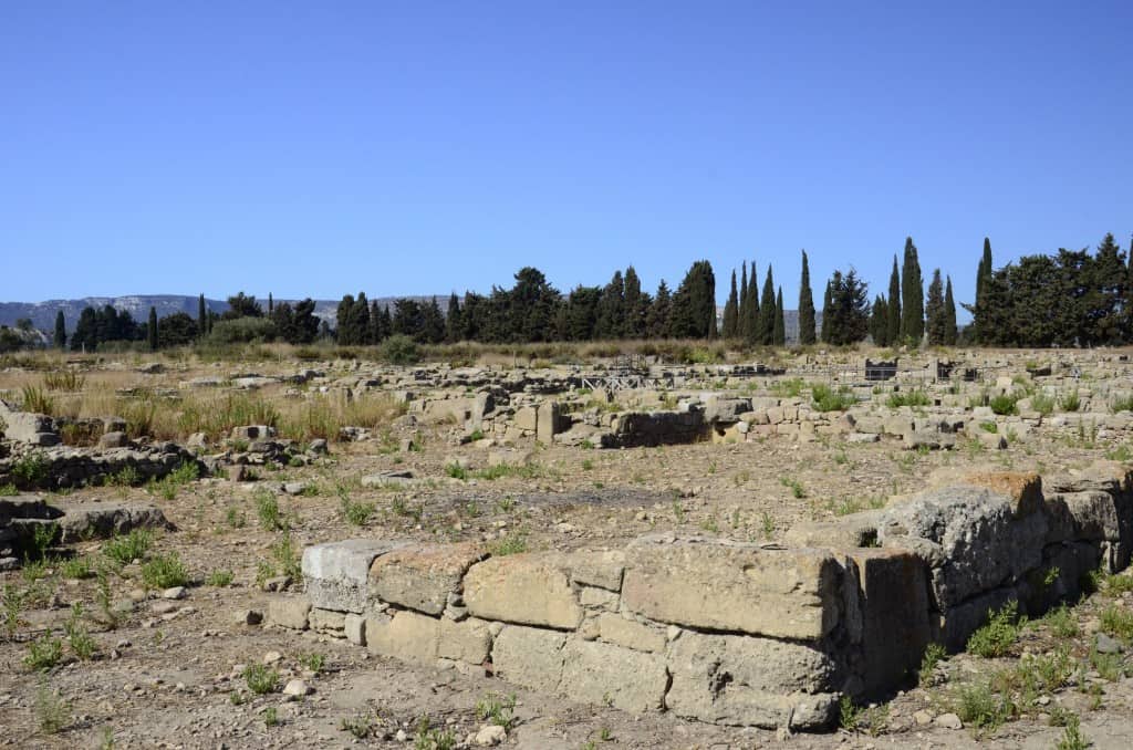

The excavations after 1948 restarted from École Française de Rome and revealed the area of the archaic agora, surrounded by impressive public buildings and various residential quarters. After we walked the path looking at the narrow streets between the houses and the larger road leading to the Agora, we had a rest looking all around from the center. A beautiful view of the cypress trees protecting the north side, the fields on the west and at the east side the sea where the port was.
Being alone we imagined life during the 8thcentury how the habitants would greet their ships arriving in the bay coming from their original land Megara. But also thought how sad was to see these cities destroyed by their neighbor cities and now days being surrounded by all these oil refineries.
After the Second World War there was an industrial expansion plan by Enrico Mattei, a public administrator, in the whole of Sicily in order to help the economy of the region, but instead it caused significant damage to the area’s visual appearance and touristic appeal. An environmental catastrophe that was apparent in Megara Hyblaea more than anywhere else has caused the place to abandon to its fate.
Tauromenium (Taormina) and a visit to Aetna
Our next visit was Taormina, ancient Tauromenium a city developed about 403 B.C. after the destruction of Naxos (5 km away on the coast) found by Chalcidians and Naxians about 734 B.C. Today the town with nice coloured houses is picturesque but very touristic.
View from Taormina town, left the Rada of Taormina and the NE Sicilian coast at the top the south of Reggio di Calabria and Motta San Giovani and Porto Salvo in mainland Italy.
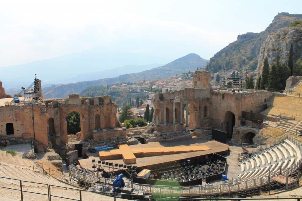
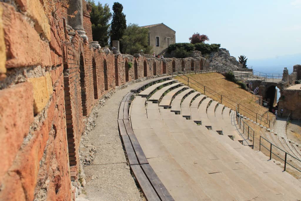
The Greek Roman Theater built 265 B.C. Left: view of the theater preparing a summer play, on the left Aetna with clouds.
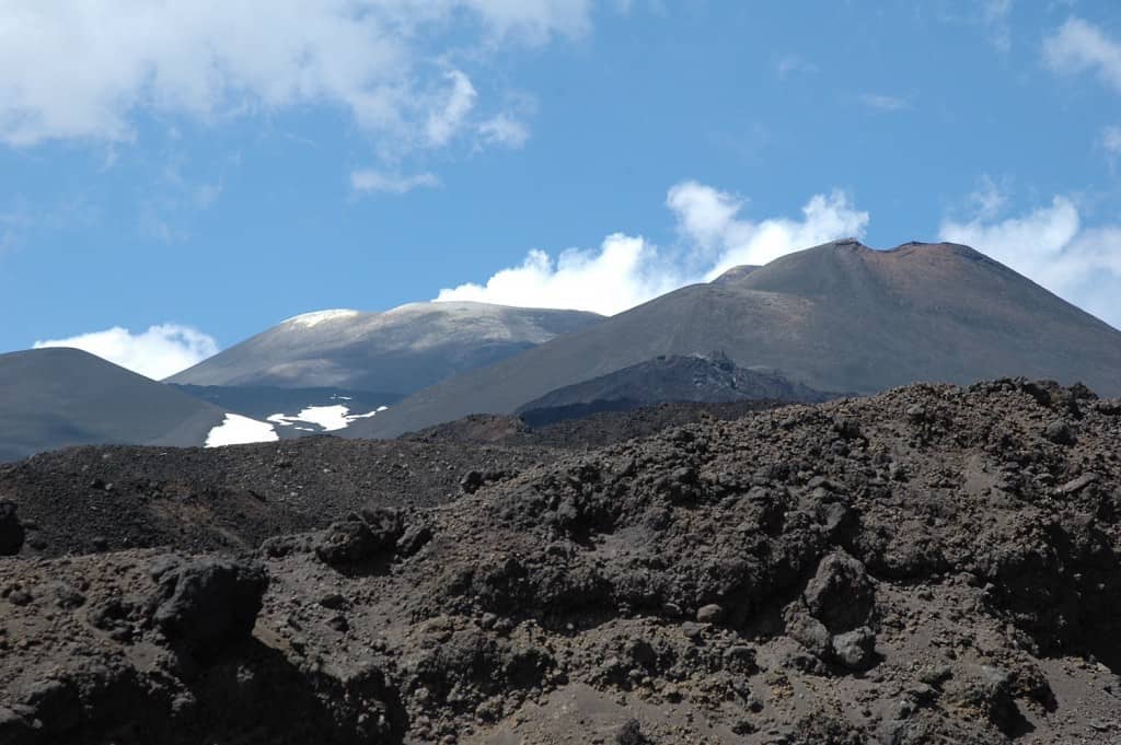
Aetna 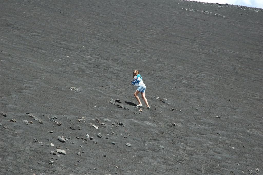
Climbing Aetna 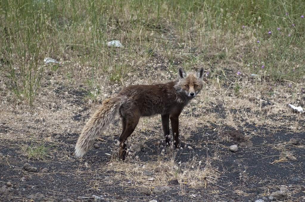
Aetna Fox
From Syracuse to Gela, Akragas
Our visit of the East coast of Sicily was coming to the end, it was time to leave the magnificent city of Syracuse and its sheltered port. We left in the morning with little wind, the mainsail up and the motor on.
Our course was south close to the rocky east coast of Sicily. We stopped between Isla Capo Passero and the village of Portopalo (Terra Nobile) for a swim and a late lunch surrounded by small boats full of people fishing, singing, and barbecuing, Sicilians having a great Sunday.
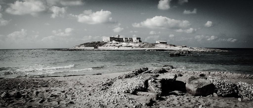
Photo from www.terra-nobile.it
At about eight in the evening we left with destination Gela with a nice breeze from the west and we were making good way parallel to the western coast. Unfortunately, the wind coming from our nose was bringing us the smell of the refineries, so we decided to pass Gela, a city found by Dorian colonists from Crete and Rhodes in 688 B.C. Renamed “Terranova di Sicilia” in 1927 and again renamed to Gela. During the Allied invasion in Sicily in the II World war a Battalion landed on the beaches of Gela and repelled Italian and German armored counter attack.
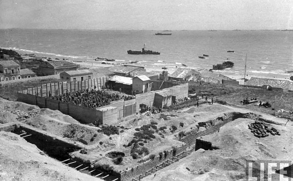
POW camp in Gela (photo from LIFE magazine)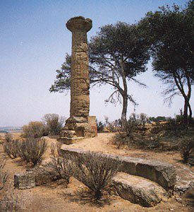
Gela’s ancient ruins (from Brittanica)
Akragas – Agrigento
The people from Gela in 582 B.C. when they decided to move west, partly in an attempt to stem the ambitious advances of Selinunte and partly because the land in the area was ideal for cultivating olives, grapes and cereal found Akragas, our next visit.
We continued our sail with a light breeze and we arrived in Licata where we found a good sheltered marina under construction with very rich muddy bottom a great holding for our Delta anchor. No interest to get on land with the exception of the greatest gellato in Sicily a secret to be kept from our children.
We decided to have a rest and sailed very early next morning to Port Empedocles the fishing and commercial port close to Akragas. Four hours later we arrived and as soon as we berthed, jumped in a taxi and went straight to the Valley of the Temples. It was a great short ride through fertile land on both sides of the road. No wonder Akragas became prosperous and in its glory days was one of the most important and most culturally-advanced Greek cities in the Mediterranean.
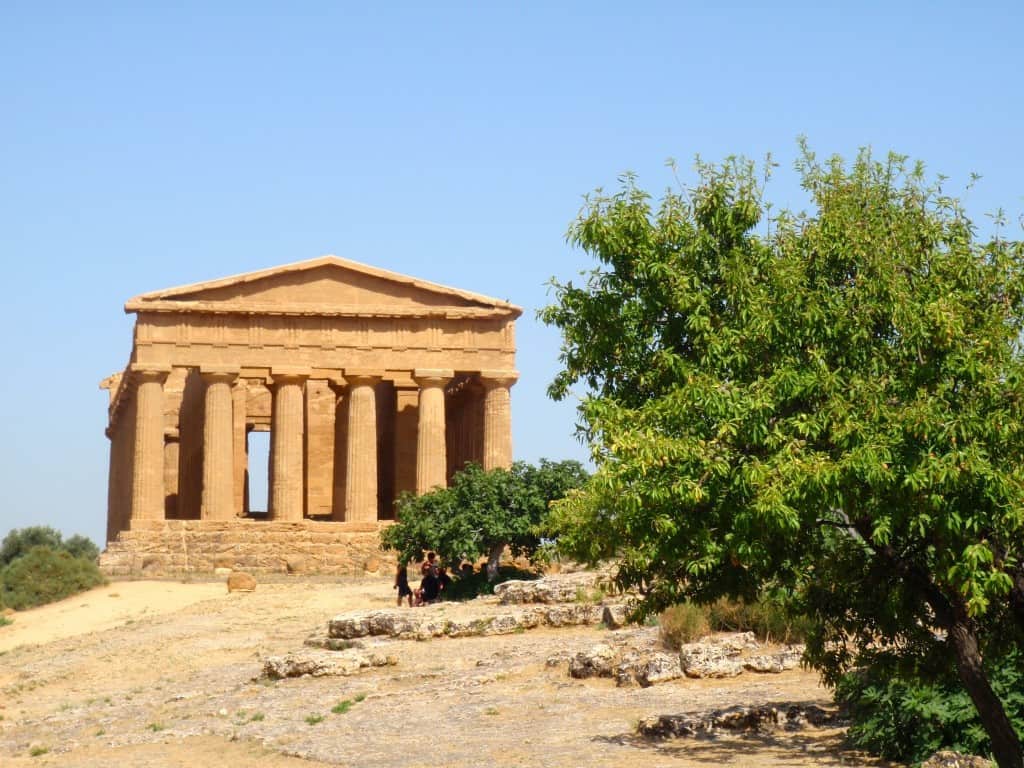
The Temple of Concordia 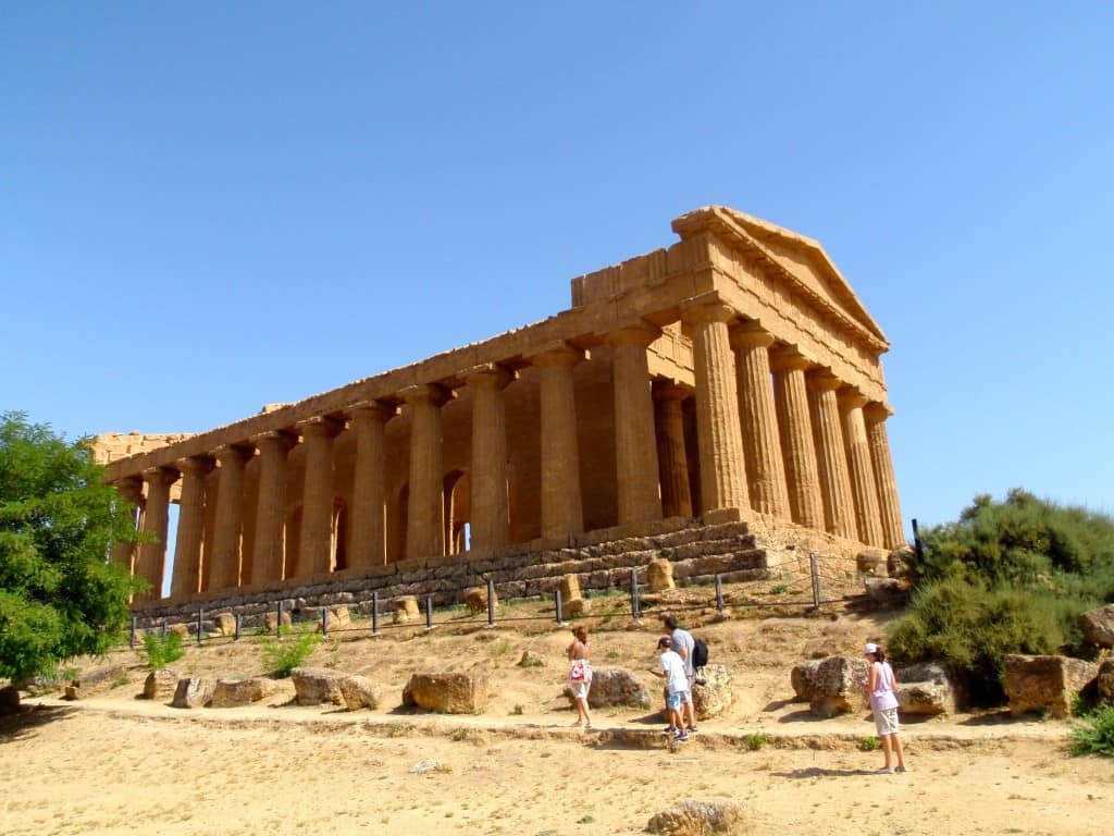
The Temple of Concordia 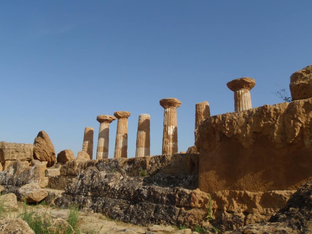
The Temple of Heracles 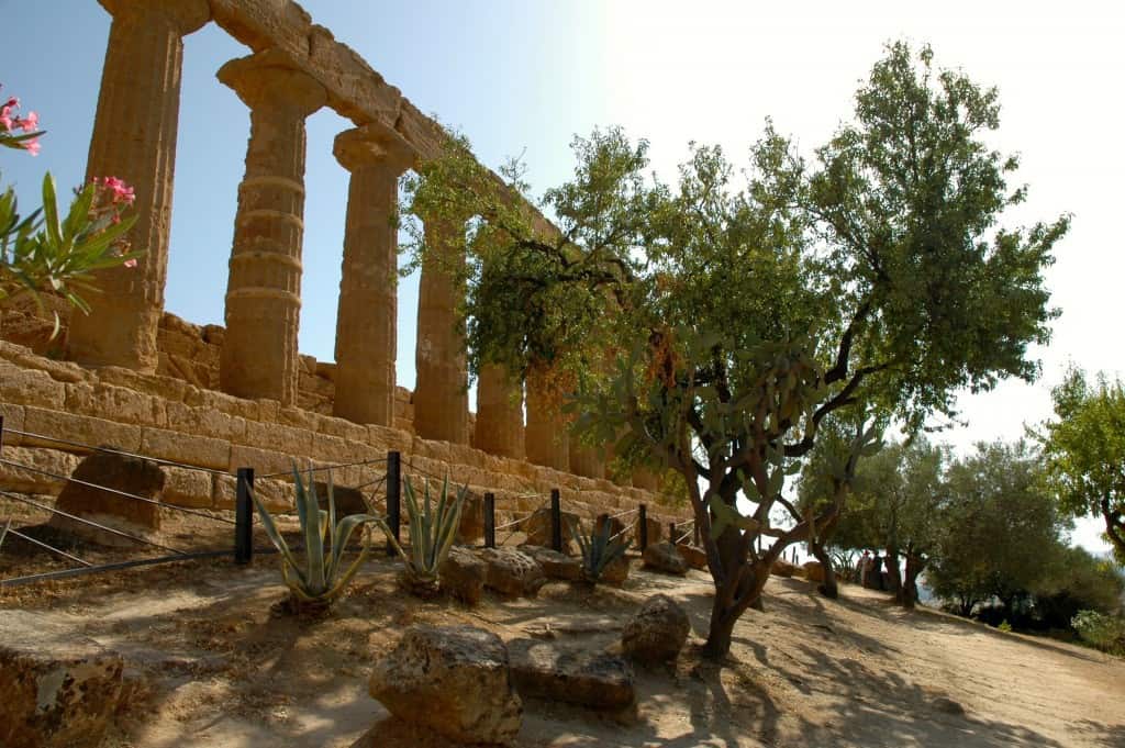
The Temple of Juno 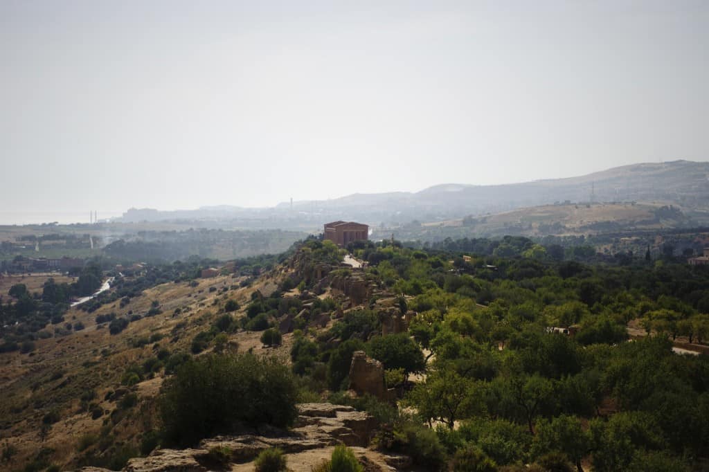
Akragas, northwest view 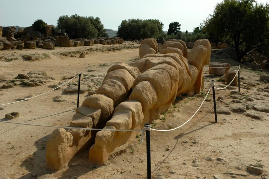
Atlas of Telamon 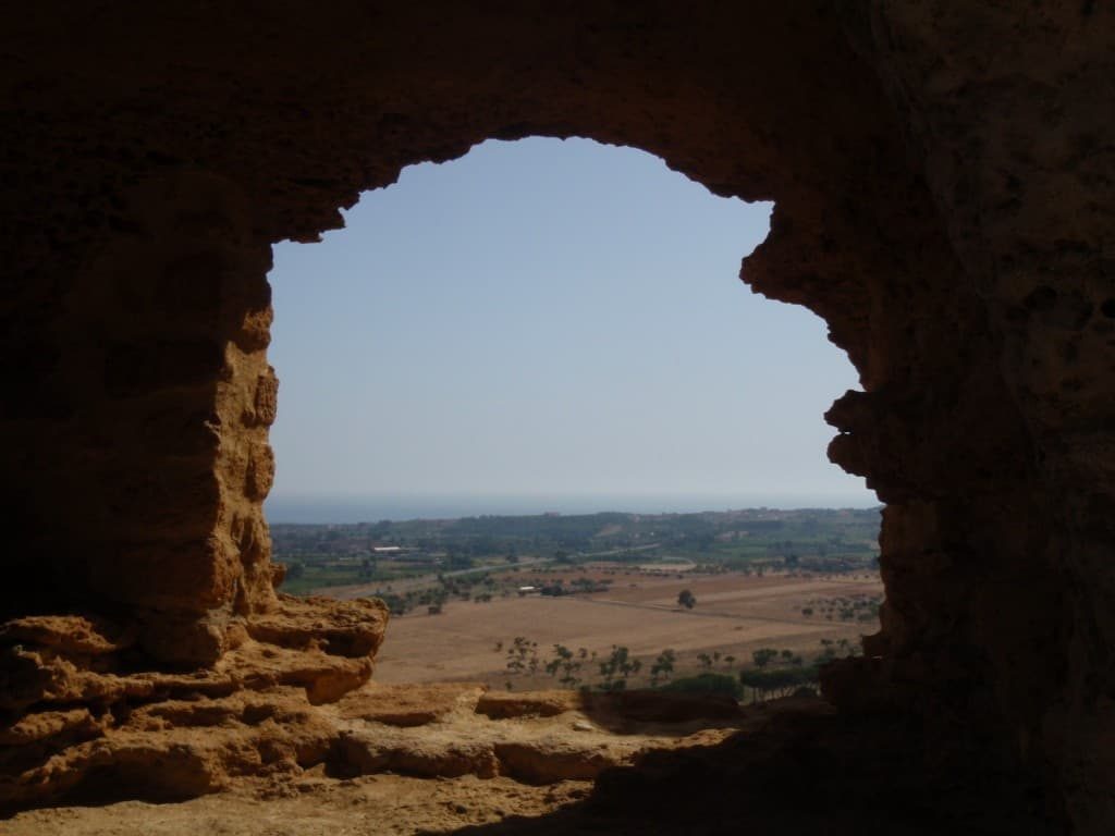
The view from the Roman walls of the rich land and the Med
Related Posts
 Voluntary taxation: a lesson from the Ancient GreeksIn this age of the super-rich, perhaps it’s time to revive liturgy. It worked for the ancient Athenians, and perhaps it could work for us
 Cambridge and Museum of Fine Arts, BostonHistorical towns that kept old buildings, cobbled streets founded by English Puritans in 1630.
 Ένα σύμβολο του αθηναϊκού μεταπολεμικού μοντερνισμούΈνας περίπατος σε μια από τις πιο πυκνοδομημένες συνοικίες της … Ευρώπης, στην Κυψέλη, μπορεί καμιά φορά να επιφυλάσσει και απρόσμενα […]
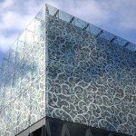 H επιστροφή της δαντελωτής αρχιτεκτονικήςΤα κενά στα δαντελωτά σχέδια επιτρέπουν στις κατασκευές να αναπνέουν και να ενισχύουν τα παιχνίδια της σκιάς και του φωτός, την αίσθηση […]